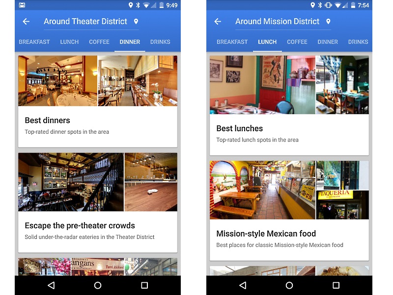
Google last year added Foursquare-like functionality with an Explore button in its Maps app. The move was seen as an attempt to make the Maps app more than just a location and direction finder. Now, the company has updated the feature to offer curated recommendations to users. Additionally, Google in order to simplify its Maps Web Service APIs has introduced a new model for developers. The company has also launched its Street View as a standalone app.
Now, the Explore feature in Google Maps for Android has received some handy additions such as curated recommendations. The company updated the Explore feature on Wednesday in limited regions including the UK and the US. According to Google Maps’ Murali Viswanathan, Senior Product Manager, the new Explore feature will allow users to “uncover the best of city has to offer.”
Viswanathan in his blog post on Wednesday added that users in New York, San Francisco, and London will get curated recommendations from Google Maps. He said, “With today’s Google Maps update, no matter the occasion – think lunch nearby right now or best spots for dinner with kids this weekend – you can be confident that Google Maps has you covered.”
Once a user picks a category, the Explore feature in Maps will offer in-depth details about each location. The feature will also show images, details from family or friends who had visited the same location earlier, and even ratings and reviews from Google via other users.
The Explore feature will also offer a suggested eatery for lunch or dinner to users based on location and time of day apart from showing nearby neighbourhoods as suggestions for visiting.
“And if you don’t find the perfect place at first glance, you can choose to load more places from the area, expand the area or switch to a different category,” writes Viswanathan.
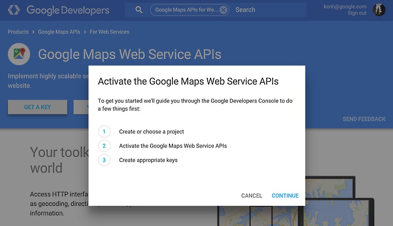
In other news, Google launched a new “pay-as-you-go” model for Maps API to simplify scaling the Web Service APIs for developers.
The Google Maps Web Service APIs offer toolkit including geocoding, directions, elevation for any point on earth, and snapping GPS crumbs to the road network for developers.
“In this new purchasing structure, the Google Maps Geocoding, Directions, Distance Matrix, Roads, Geolocation, Elevation, and Time Zone APIs remain free of charge for the first 2,500 requests per day, and developers may now simply pay $0.50 USD per 1,000 additional requests up to 100,000 requests per API per day,” said Ken Hoetmer, Product Manager, Google Maps APIs.
 The company notes that those developers who require over 100,000 requests per day can contact the company to purchase a premium licence.
The company alongside updated Google Maps/Earth APIs Terms of Service to include a section on payment terms and clarifications to the deprecation policy, turn-by-turn navigation restrictions and derivative data sets.
Google on Wednesday also released a standalone app for its Street View service, which was earlier a part of Google Maps. Dubbed Street View on Google Maps, the app is now available to download on Google Play.
Notably, the new app listing for Street View doesn’t include much about what it does and instead notes, “To use Street View, open Google Maps, search for a place or long-press the map, and tap the Street View option.” Android Police after a teardown claims that the new Street View app includes a built-in camera for taking photospheres.
[“source-gadgets.ndtv”]


